
Day 1
Around the Town
HIGHLIGHTS
Flinders Discovery Centre
Federation Rotunda
Historic Coolibah Tree
MORNING
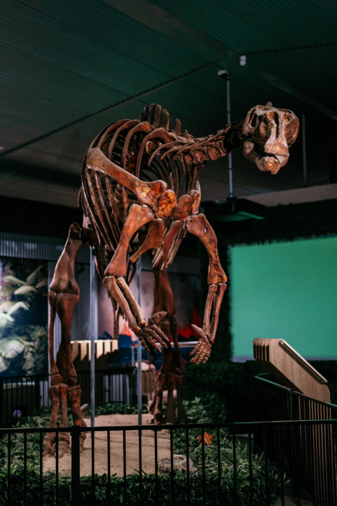
Spend the morning discovering the history of Hughenden and district at the Flinders Discovery Centre. Step back in time inside our museum and see the exhibition of dinosaur fossils from around the world and a growing display of fossils from our local area. Meet ‘Hughie’ our seven metre skeletal Muttaburrasaurus and much more. The Flinders Discovery Centre is also an accredited Information Centre.
AFTERNOON
Spend the rest of the day exploring the town’s history, with the historic Coolibah Tree and the Surveyor’s Peg and Hebrew grave. A wide range of sculptures and the Federation Rotunda dominates the streetscape of Brodie Street. This Rotunda is made from two 20’ windmills brought into Hughenden from a property south of Prairie. Relax under the curved roof while sitting on original bush furniture which has been created by local residents.
EVENING
Walk along the banks of the Flinders River at the Robert Gray Memorial Park. This Park area is dedicated to local characters and pioneers of the district. Plaques have been placed on the rocks scattered along the footpath winding through the park. Facilities include free BBQ’s and picnic areas. Enjoy a walk along the diverse bioregions of the Eco Walk on Flinders. These eco-systems have been replicated along the northern banks of the Flinders River with over 1.5km of walking tracks. Throughout the park there are picnic shelters, tables, viewing platforms and drinking fountains.
Day 2
Porcupine Gorge National Park / Mount Walker Lookout
JOURNEY
Hughenden to Porcupine Gorge National Park ………. 63 kms north/1 hour 5 minutes
Hughenden to Mount Walker Lookout …………………. 8 kms south/10-15 minutes
MORNING
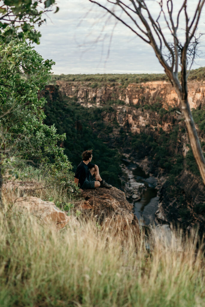
Start the day early and head north to Porcupine Gorge National Park (63km) and spend the morning
exploring the diverse range of flora and fauna that exists amongst the coloured volcanic basalt countryside and sandstone rocks, Fill your day with bush walking, bird watching and swimming. The first Lookout gives you an indication of the depth and magnitude of the Gorge. Camping is allowed for those wishing to stay, otherwise head back into Hughenden.
AFTERNOON
If back in time to view the sunset, Mount Walker Lookouts would be the place to go, approximately 8km south of Hughenden. Mount Walker boasts six spectacular lookouts scanning the district over 360° and stands 478m above sea level.
Day 3
Kooroorinya Falls Nature Reserve / 4WD Track
JOURNEY
Hughenden to Koorooinya Falls…………….approximately 98km /1hour 20minutes
attraction- Kooroorinya Falls Nature Reserve
Camping sites offer modern toilet facilities, hot showers and wood fired barbeque.
Campers must call into the caretaker’s office prior to setting up. This area comes alive each year at the Oakley Amateur Picnic Races held each May.
MORNING
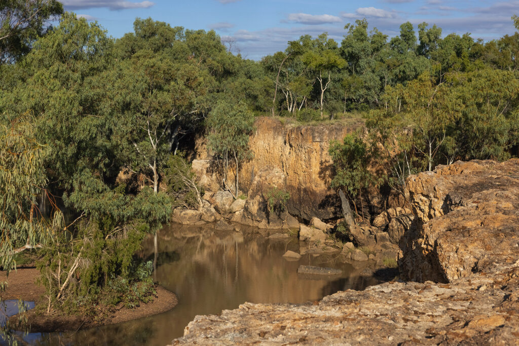
If travelling west to Townsville, a must-stop for any one visiting would be Kooroorinya Falls Nature Reserve. Travelling 54km south of Prairie on the Muttaburra Road is the natural surrounds of Kooroorinya Falls.
Kooroorinya Falls Nature Reserve is an example of a pristine outback environment. ‘In the wetter months of the year, a billabong remains for most of the year at the top of the falls with a swimming hole at the base.
Kooroorinya offers camping grounds, cold showers and toilet facilities. All campers must report to the Caretaker for camping permits.
FOR THE 4WD DRIVE ENTHUSIAST
JOURNEY
Basalt Byways……………………. approximately 99kms/1hour 20minutes
Flinders River Byway…….. approximately 104kms/1hour 30minutes
Eromanga Sea Byway…… approximately 158kms/2 hours 10minutes
Flinders River Byway
The Flinders River Byway is a loop road from the Kennedy Developmental Road north of Hughenden, taking you across to the smaller township of Prairie. Crossing the Flinders River, this drive offers scenic lookouts over sparse changing landscapes.
Eromanga Sea Byway
This scenic drive takes you through a diversity of landscapes from blacksoil downs through rolling Mitchell Grass plains and up to the desert uplands.
About one hundred and ten million years ago a shallow sea covered what is now arid inland Australia. Australia’s most beautiful and complete fossils of this period are of the spectacular marine creatures that lived in this cold sea.
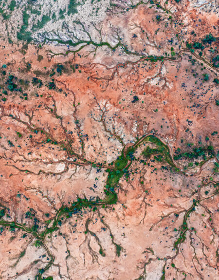
Basalt Byway
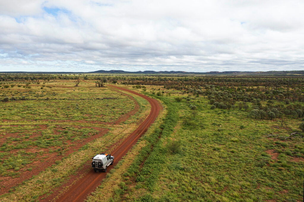
The Basalt Byway is a 4WD track winding between the landscapes north of Hughenden, running for approximately 95km. This track takes you on a journey through some amazing country featuring rolling landscapes of basalt walls and deep valleys. Basalt Rock is typically the first lava to issue from a volcano.
This area and soil type is very nutritious and is classed as prime grazing land. The area you travel though has a large diversity of soils and nature. Boasting some excellent lookouts to view from and showing the depth and length of many of the valleys you will wind through. One lookout in particular shows an open downs area with the town of Hughenden in the distance.
What's on